Mumbai - Bombay streets map
You can find on this page the Mumbai - Bombay streets map to print and to download in PDF. The Mumbai - Bombay roads map presents the road network, main roads, routes and motorways of Mumbai - Bombay in Maharashtra - India.
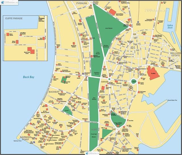
Mumbai - Bombay streets map
The Mumbai - Bombay streets map shows all street network and main roads of Mumbai - Bombay. This streets map of Mumbai - Bombay will allow you to find your routes through the streets of Mumbai - Bombay in Maharashtra - India. The Mumbai - Bombay streets map is downloadable in PDF, printable and free.
Travelers are voting Dadabhai Naoroji Road, Pedder Road and Colaba Causeway as the best of 11 famous streets in Mumbai. There are 1 famous street in Palghar a city just 113 km from Mumbai and 7 famous streets in Pune which is 148 km distant as you can see in Mumbai - Bombay streets map. The most popular of these are Railway Road in Palghar and Kasba Peth in Pune. You can find 20 famous streets in Maharashtra and 75 famous streets in the country of India.
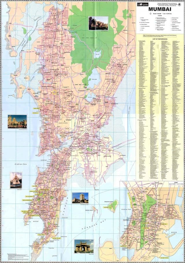
Mumbai - Bombay roads map
The Mumbai - Bombay roads map shows all road network and highways of Mumbai - Bombay. This roads map of Mumbai - Bombay will allow you to find your routes through the roads and motorways of Mumbai - Bombay in Maharashtra - India. The Mumbai - Bombay roads map is downloadable in PDF, printable and free.
During the early 1970s, in an effort to relieve road congestion, Salsette Island was linked to the mainland by a bridge across Thana Creek, the headwaters of Mumbai Harbour. More express highways and more bridges have been built since then as its mentioned in Mumbai - Bombay roads map. Notable additions to the road network are the Banda-Worli Sea Link (opened 2009), which bridges Mahim Bay on the west side of the city, and a new expressway between eastern Mumbai and Navi Mumbai (opened 2014) that supersedes the earlier Thana Creek bridge.