Mumbai - Bombay metro map
You can find on this page the Mumbai - Bombay metro map to print and to download in PDF. The Mumbai - Bombay metro map presents the network, zones, stations and different lines of the metro of Mumbai - Bombay in Maharashtra - India.
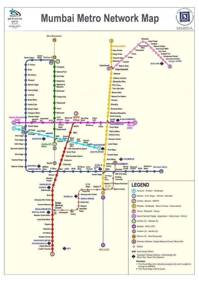
Metro map Mumbai - Bombay
The Mumbai - Bombay metro map shows all the stations and lines of the Mumbai - Bombay metro. This metro map of Mumbai - Bombay will allow you to easily plan your routes in the metro of Mumbai - Bombay in Maharashtra - India. The Mumbai - Bombay metro map is downloadable in PDF, printable and free.
Metro Mumbai - Bombay is a rapid transit system under construction in the Indian city of Mumbai. The system is designed to reduce traffic congestion in the city, and will be built in three phases over a 15-year period, with overall completion expected in 2021. When complete, the system will comprise three high-capacity metro railway lines, spanning a total of 63 kilometres (39 mi) as its mentioned in Metro map Mumbai - Bombay. The Mumbai Metro operator is Mumbai Metro One Pvt Ltd (MMOPL), a joint venture company formed by Reliance Infrastructure, Veolia Transport and the Mumbai Metropolitan Region Development Authority (MMRDA).
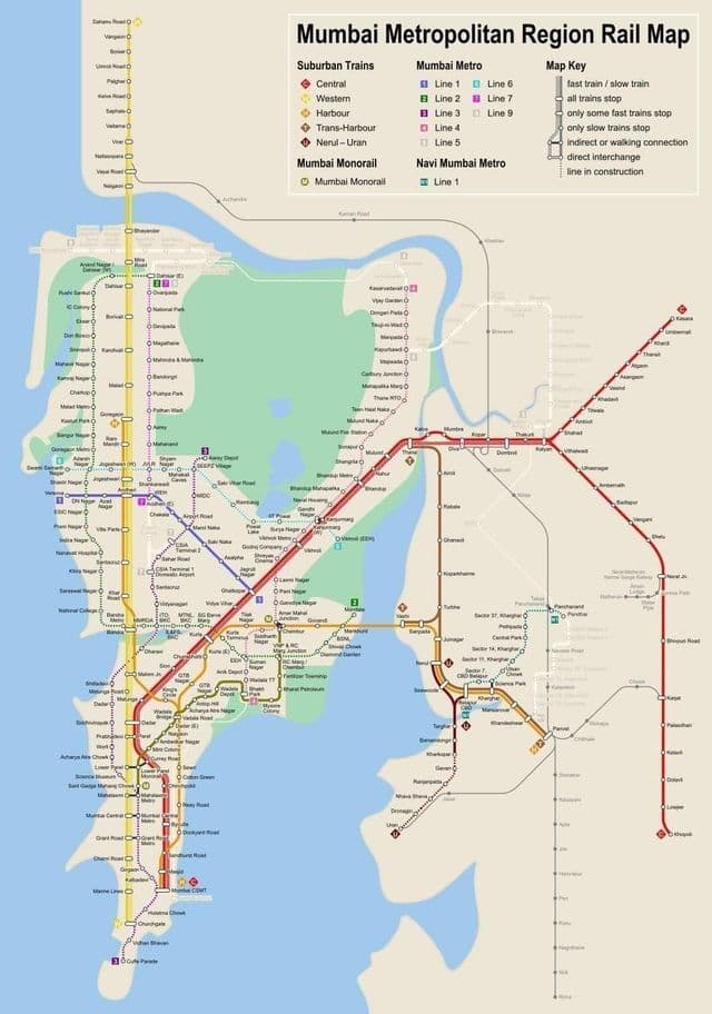
Mumbai - Bombay subway map
The Mumbai - Bombay subway map shows all the stations and lines of the Mumbai - Bombay subway. This subway map of Mumbai - Bombay will allow you to easily plan your routes in the subway of Mumbai - Bombay en Maharashtra - India. The Mumbai - Bombay subway map is downloadable in PDF, printable and free.
The eight lines of the Mumbai - Bombay subway system are projected to have a total length of approximately 146 kilometres (91 mi) as its shown in Mumbai - Bombay subway map. In 2011, the MMRDA unveiled plans for an extended Colaba-Bandra-SEEPZ metro line. According to its earlier plans, a 20-km Colaba-to-Bandra metro line was to be constructed, running underground for 10 kilometres (6.2 mi) from Colaba to Mahalaxmi, and then on an elevated track from Mahalaxmi to Bandra. However, the MMRDA decided that extending the line through Bandra to the Chatrapati Shivaji International Airport would increase the number of commuters.